
Hong Kong Learning Guide: Harbour, Maps, Museums and Time
Explore Hong Kong Learning Guide with clear explanations, worked examples, source checks and practical questions for independent student learning.
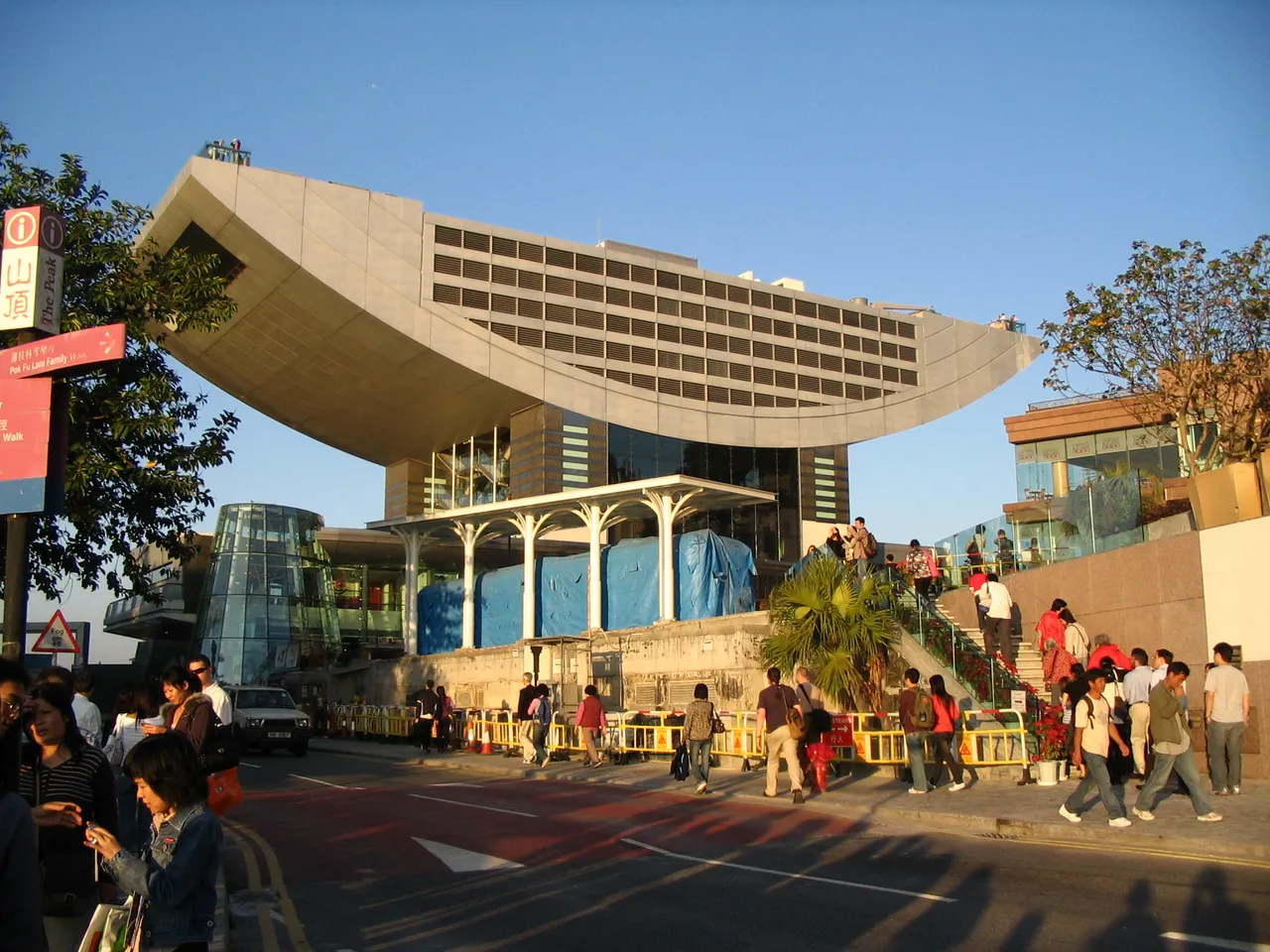
Hong Kong can be explored through geography, public transport, museums and the way a dense waterfront city is represented on maps. Victoria Harbour lies between Hong Kong Island and Kowloon, a relationship identified by the Hong Kong Tourism Board. Understanding that basic layout is more useful than treating every familiar skyline photograph as though it showed the same neighbourhood or viewpoint.
This educational guide was checked on 2 November 2026. It does not claim a personal visit, provide current ticket prices or offer immigration advice. The activities use original maps and fictional journey calculations. For an actual visit, check current official arrangements for the specific attraction, transport service and personal travel requirements.
How should you begin with the geography?
Start by distinguishing Hong Kong Island, Kowloon and the wider places included in the destination's official regional navigation. A skyline view often captures only part of that setting. A photograph looking across Victoria Harbour cannot, by itself, represent every residential area, outlying island or landscape in the wider territory.
The Tourism Board locates Victoria Harbour between the island and Kowloon. Use that relationship as an anchor before adding individual landmarks. A learner who knows which shore they are looking toward can interpret a photograph more accurately than someone memorising building names without a spatial framework.
For an original classroom model, draw two simplified land areas and a waterway between them. Mark the drawing as schematic, not to scale. Add a north arrow and ask which information the diagram provides and which it omits. A simplified map can be useful without pretending to replace a detailed current map.
Why does a viewpoint matter?
A photograph is taken from a position, in a direction and at a particular time. The same harbour can look different from opposite shores or from a higher elevation. A caption should identify the viewpoint where known rather than assuming that every image of the skyline communicates the same geographic relationship.
For an original exercise, place a model building between two paper shorelines and draw it from each side. Ask which features remain visible and which disappear. The activity demonstrates perspective without requiring a real trip or a claim about a particular building's present appearance.
Do not infer a walking route from a photograph alone. Water, access restrictions, elevation and transport connections may lie outside the frame. A visually short distance across an image is not automatically a short or direct journey on the ground.
What is the difference between a map and a transport diagram?
A geographic map aims to represent spatial relationships according to its scale and projection, while a transport diagram may simplify distance and direction to emphasise connections. Both can be useful, but they answer different questions. A line that appears short on a diagram does not necessarily represent the shortest travel time or walking distance.
Use an original fictional network with three stops. Draw the connections once geographically and once as a simple straight-line diagram. Ask students which display makes transfers easier to understand and which better supports a distance estimate. The comparison teaches purpose rather than declaring one format universally superior.
For actual travel, use the relevant operator's current route and service information. This article does not invent a timetable or promise that a historical route remains unchanged. A learning diagram should stay clearly separate from practical navigation advice.
How does Hong Kong time compare with Pakistan time?
The Hong Kong Observatory identifies Hong Kong Standard Time as UTC+8. Pakistan Standard Time is UTC+5, so the difference between those stated offsets is three hours. Keep the date as well as the clock time when converting, especially near midnight.
For an original example, a fictional online event at 18:00 Hong Kong time corresponds to 15:00 Pakistan time under those offsets. An event at 01:00 in Hong Kong corresponds to 22:00 on the previous Pakistan date. Subtracting hours without checking the calendar can produce a correct clock reading attached to the wrong day.
Do not convert a time that a website has already adjusted to your device without checking its label. A listed local time, UTC time and device-local display can all refer to the same moment. The source's time-zone information is part of the event record, not optional decoration.
What can a museum teach about a place?
A museum can connect objects, interpretation and public history, but its displays should still be read critically and within their stated scope. The Hong Kong Museum of Art's official site offers collection and exhibition information and identifies its Tsim Sha Tsui location. Those resources provide a starting point for an art-learning activity without requiring a claim about every current display.
Separate the artwork or object, the label and your interpretation. A label may provide artist, date, material and context. Your response can discuss shape, colour or meaning, but should not silently replace the institution's factual information with a guess from appearance.
For an original worksheet, use four fields: what I can observe, what the label states, what I infer and what I still need to know. The structure helps students appreciate an object while recognising the difference between evidence and personal response.
Why should opening hours be checked separately?
General descriptions can remain useful for years, while practical arrangements can change for holidays, maintenance, special events or other reasons. A current official visitor page is more appropriate for a planned visit than a cached timetable copied into a long-lived article.
This guide therefore does not freeze the museum's displayed hours into a promise about a future day. It also does not claim that every exhibition has the same admission arrangement. Check the relevant institution's current visit information for the exact date and activity being considered.
For an original planning exercise, give a fictional museum one regular schedule and one dated exception. Ask which applies to a hypothetical visit. The task teaches why a specific exception can matter more than a familiar general rule, without inventing actual visitor arrangements.
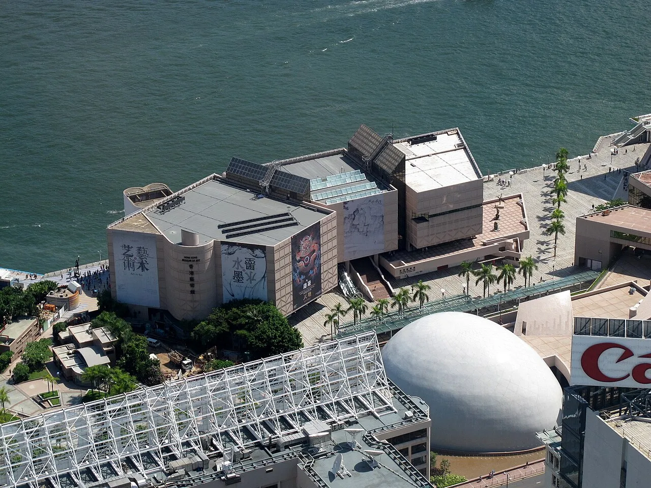
Historical museum exterior, not a current visitor-arrangement notice.
How can a harbour be studied as a system?
Consider separate layers: physical geography, movement, land use, public space and cultural interpretation. A harbour is not only a view. Different users and activities can share the same setting, and a map or photograph may emphasise one layer while leaving others outside the frame.
For an original classroom diagram, place fictional routes, public spaces and buildings around a waterway using different symbols. Add a legend and explain what each layer represents. Do not treat the diagram as a measured Hong Kong planning map or infer current traffic volumes from its decorative arrows.
The system approach encourages questions that can be researched independently. Which source describes the geography? Which operator describes a transport route? Which institution explains a museum collection? One tourism photograph cannot supply every answer, even when it is a useful introduction.
What is a useful way to calculate journey time?
Separate movement time, waiting time and transfers in the model. A distance divided by a hypothetical average speed gives only one part of a journey. It does not automatically include access, queues, boarding or service disruption. State the assumptions rather than presenting a simplified result as a real timetable.
For an original fictional route, imagine ten minutes of movement, five minutes waiting and seven minutes walking to the destination. The model totals twenty-two minutes. If the waiting assumption changes, the answer changes. None of those values is a current Hong Kong service estimate.
This is a transferable planning skill. A neat arithmetic answer can still be incomplete if an important component is omitted. A classroom worksheet should make the components visible so that a learner can explain both the calculation and the limits of the model.
How do scale and distance work on a map?
A scale connects a distance on the map with a distance in the represented area. Use the stated scale and units before calculating. A resized screenshot may no longer support a ruler measurement unless its scale reference is preserved appropriately. Do not assume that two maps displayed at the same screen size have the same geographic scale.
For an original exercise, use a fictional map where one centimetre represents half a kilometre. Four centimetres then represents two kilometres under that model. The calculation does not establish a walking route, because route length can differ from a straight-line map distance.
Add a water barrier to the fictional map and ask how the practical route changes. This demonstrates why geography and network access both matter. A correct straight-line distance can be useful while remaining insufficient for a real travel-time claim.
Can a skyline image establish current conditions?
A historical image can show a skyline at its recorded moment, but it does not prove today's weather, visibility, construction status or crowd conditions. Keep the source date and viewpoint in the caption where available. Avoid using an old clear-sky photograph to imply a current weather observation.
For an original media-literacy activity, compare a dated photograph with a proposed caption saying “today.” Ask what evidence would be needed to support that word. The photograph's authenticity is not enough; the timing claim is a separate assertion.
This is particularly useful when a destination is trending because of a sports event or public occasion. A city image can illustrate the host location without documenting the event itself. Honest context helps readers understand the relationship instead of mistaking a generic view for firsthand coverage.
How can students build a small research project?
Choose one question: how the harbour separates two areas, how a museum labels an artwork or how a time-zone conversion changes the date. A focused question makes it easier to choose sources and explain the conclusion. Trying to summarise every part of Hong Kong at once can produce a page of unrelated facts with little understanding.
Create a source log with the question, official page, date checked and relevant field. Put your own drawing or calculation in a separate section. If a current fact is missing, mark it unresolved rather than copying an unsupported number from a search snippet.
Finish with a short explanation that another learner can check. The project does not need a claim that a place is biggest, best or most visited. It needs a clear relationship between the question, the evidence and the answer.
What should readers avoid assuming?
Do not assume that a city guide establishes entry permission, that a photograph proves current weather or that a route diagram provides a live timetable. Those questions require their own current official sources. This article's purpose is educational understanding, not a personalised travel plan.
Similarly, do not equate one familiar neighbourhood with the whole destination. A harbour photograph, museum page and regional map each reveal part of the setting. Understanding improves when those parts are connected carefully rather than treated as interchangeable descriptions.
For an original final activity, ask students to name one question each source can answer and one it cannot. The exercise makes source scope visible and reduces the temptation to stretch an attractive image or official-looking page beyond the information it actually supplies.
What should you remember?
Begin with geography, preserve the viewpoint of an image and distinguish a map's purpose from a transport diagram's purpose. Keep time-zone offsets and dates together, use museum labels thoughtfully and verify practical arrangements separately when they matter. A place becomes easier to understand when its information is organised by question and source.
Explore more geography and cultural-learning guides for related activities. Hong Kong provides a useful setting for learning spatial relationships, time conversion and visual literacy without inventing current travel conditions or claiming a visit that did not happen.
Sources
- Hong Kong Tourism Board: Victoria Harbour, for the harbour's relationship to Hong Kong Island and Kowloon.
- Hong Kong Observatory: local time, for UTC+8.
- Hong Kong Museum of Art: official site, for collection, exhibition and location context. No future opening time, fare or entry permission is promised. All maps and journey calculations above are original fictional classroom models.
Image credits: cover: Minghong, source, CC BY-SA 4.0. Resized and converted to WebP. inline: WiNG, source, CC BY 3.0. Resized and converted to WebP.
Found an error or an outdated detail? Report a correction with the article URL and original source.